
Features
Everything you need to survey, plot, and sketch
Subterra Vector puts the shot table, the line plot, and the sketch on one tablet, and keeps working with no signal. Here’s what’s inside.
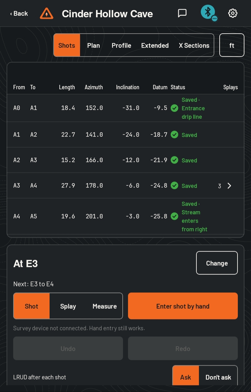
Shots go straight into the survey
Take a shot and it’s in the shot table before you’ve moved. No book to copy, no typing it up afterward.
- Shots from your survey device land in the shot table the moment they arrive.
- One switch picks what the next shot is, a survey shot, a splay, or a quick measurement that saves nothing.
- After each shot, the app asks for left, right, up, and down, and takes the next shots in order. Skip, redo, or type any wall.
- Type shots by hand on a large number pad, with or without a device.
- Edit, retake, or delete any shot. Every change can be undone.
- Stations name themselves. The main route runs A0, A1, A2, and each branch takes the next letter.
- Survey in feet or meters and switch the display any time. Your data isn’t changed.
Catch mistakes while you’re still there
Problems show up in the cave, where you can still reshoot, not at home a week later.
- Suspect shots are flagged with a plain reason and stay in the table. The app never changes your data on its own.
- Close a loop and the shot shows how far off it closed, with a warning past 2% of the loop’s length.
- Shoot a back sight and the app tells you how far it is from the shot it checks.
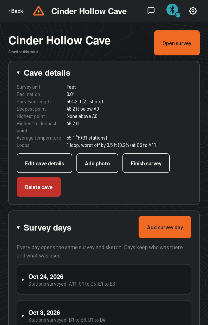
- Each cave works out its surveyed length, deepest and highest points, and average temperature as you go.
See the cave from every side
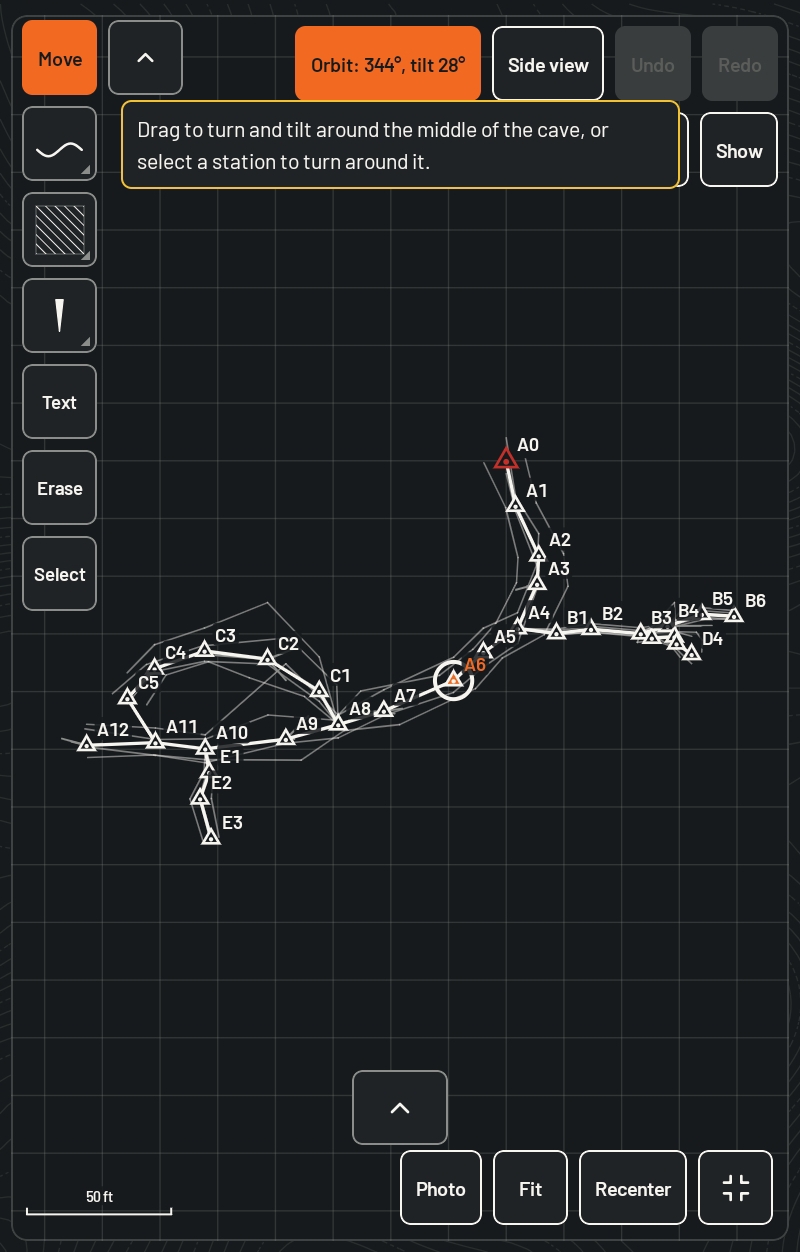
The line plot draws itself as you survey. Switch between views with one tap, and every view shares the same stations.
- The plan view draws each shot as it arrives, with left and right wall marks and splays.
- The extended profile lays the survey out flat, with each route on its own row.
- The profile shows the true side view. Orbit around the middle of the cave or any station.
- Draw cross-sections at any station, with a guide from its wall measurements.
- Fit shows the whole survey. Recenter jumps back to where you’re standing.
- Show or hide names, stations, splays, and the line plot, each on its own.
A sketch you’ll want to keep
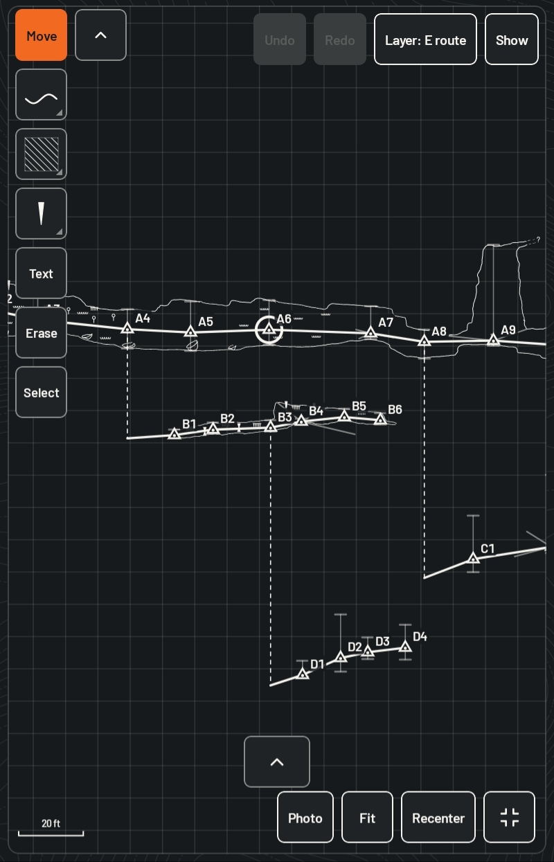
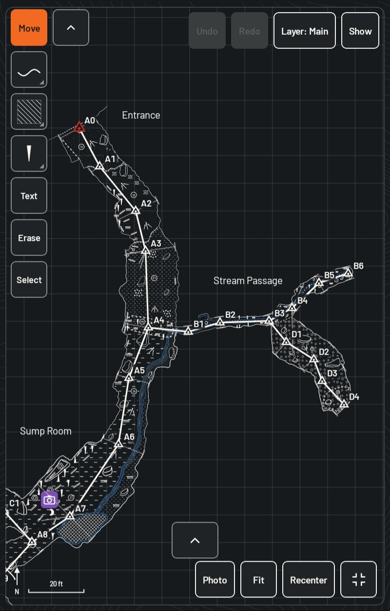
Draw with a stylus over a live line plot, with the tools a cave sketch needs, and take it home ready to draft.
- Line width follows your pen’s pressure, and your palm is ignored while the pen is near the screen.
- No stylus? Sketch with a finger.
- Solid and dashed pens in several sizes, plus ledges, drip lines, ceiling channels, domes, and breakdown walls.
- Fill an area with a color or a pattern, such as pools, sumps, mud, gravel, or breakdown.
- Sketch in layers, so lower levels stay separate. In the extended profile, each route gets its own layer.
- Add text and photo pins, select and move parts of the drawing, and undo anything.
- Every stroke is saved as a line, not a picture, so it exports with its layers.
The symbols you already use
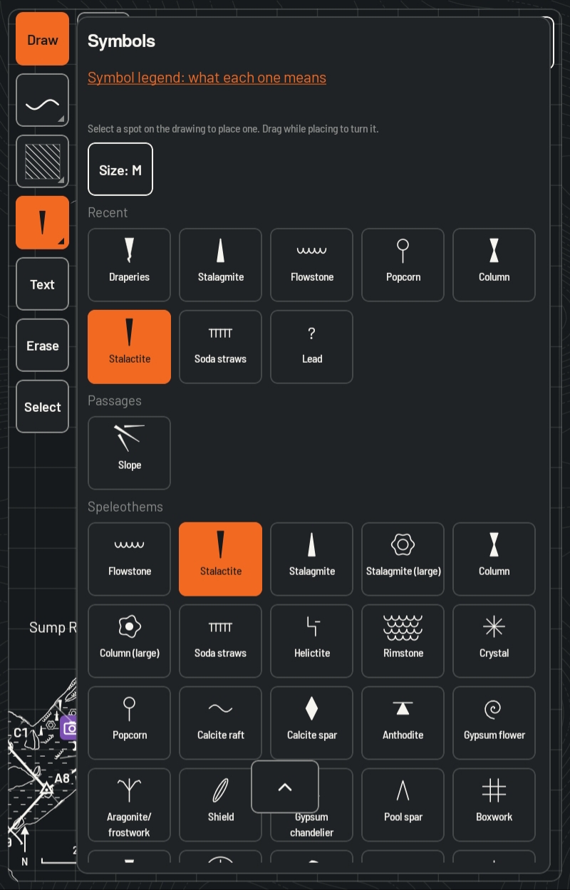
A library of cave symbols, drawn as original artwork for the app, sits one tap away while you sketch.
- Speleothems, passage features, water, and more, grouped so you can find them fast.
- Your most recent symbols stay at the top.
- A built-in legend explains what each symbol means.
- Add your own symbols from SVG files.
Works with most digital survey devices
Connect over Bluetooth, and let the app look after the connection while you look after the survey.
- One search finds supported survey devices nearby.
- A dropped connection reconnects by itself, and shots taken in the meantime still arrive, with none doubled.
- The top bar shows the device’s connection and battery at a glance.
- A warning appears when the device’s battery runs low or it may need calibrating. It never blocks the sketch.
- Connect two survey devices at once.
- A practice device lets you learn the app with no hardware at all.
Your survey stays on your tablet
No accounts, no signal needed, and nothing sent anywhere. Your caves are yours.
- Every shot, station, and sketch line is saved the moment it’s made.
- The app has no internet access, so it can’t send your data anywhere.
- Save a full backup to a place you choose, and restore it any time.
- Keep a backup up to date in your own cloud storage, if you want one.
- The app keeps its own daily copies, and a deleted cave waits in the trash for 30 days.
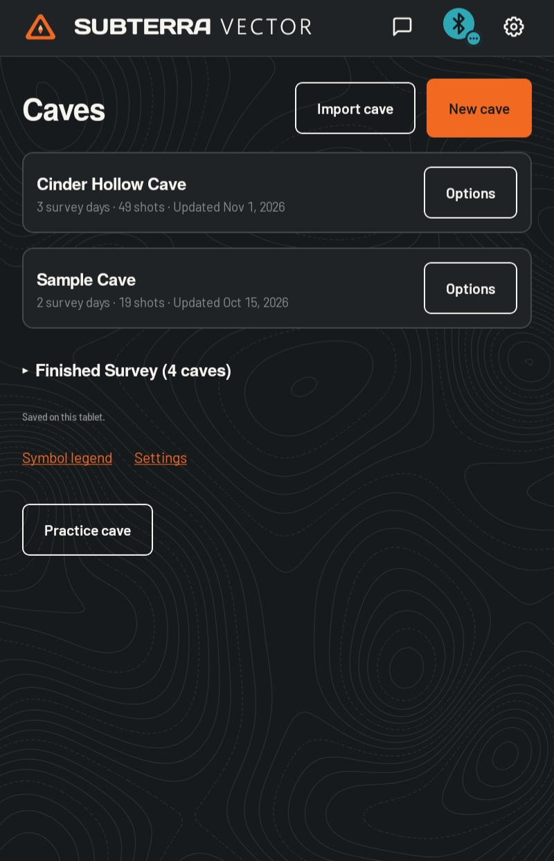
- Finish a survey to lock it, so nothing changes by accident. Reopen it any time.
Take it home ready to draft
Export the survey and the sketch in the formats you already work with.
- Export the survey to Compass, Survex, and Therion, or as CSV or a spreadsheet.
- Export sketches as SVG files that open with their layers in Illustrator and Inkscape, or as PNG images.
- Sketch exports carry the title, declination, team, surveyed length, deepest point, and average temperature.
- Entrance coordinates stay out of exports unless you choose to include them.
- Share a whole cave with another Subterra Vector user, and join their cave file into yours.
- Start a cave from a spreadsheet of shots.
Built for cold hands and dark passages
Designed on a tablet, underground, by people who survey.
- Opens in dark mode, with a light mode when you want it.
- Large controls you can hit with gloves on, and three text sizes.
- One beep or buzz for each shot, two for an error, if you turn them on.
- An option to keep the screen on while you survey.
- Runs on Android tablets and phones with Android 9 or newer. Designed for tablets with a stylus.
Get updates
Subterra Vector is coming in 2027. Email us and we’ll let you know when it’s ready.
info@subterraops.com
We use your email only for launch news. Reply any time to unsubscribe. Read our privacy policy